From raw scans to maps you'd put your name on.
Studio is three products that share one engine and one map format: Atlas, the desktop mapping studio, Explorer, the field capture app you run from a phone, and Arena, real-time camera tracking for broadcast and virtual production. Capture in the forest or on site; finish at the desk; track live in the venue.
| Platform | Linux x86-64 workstation (Atlas) · headless field computer + phone browser (Explorer) |
|---|---|
| Sensors | Ouster OS0 / OS1 / OS-series 128 · Hesai XT32 / OT128 / JT-128 · generic point-cloud streams |
| Inputs | .bag .mcap .osf .pcap · Parietra map archive · live sensor |
| Outputs | LAS · PLY · tracking map · dataset export — all from one map file |
A workflow, not a toolbox.
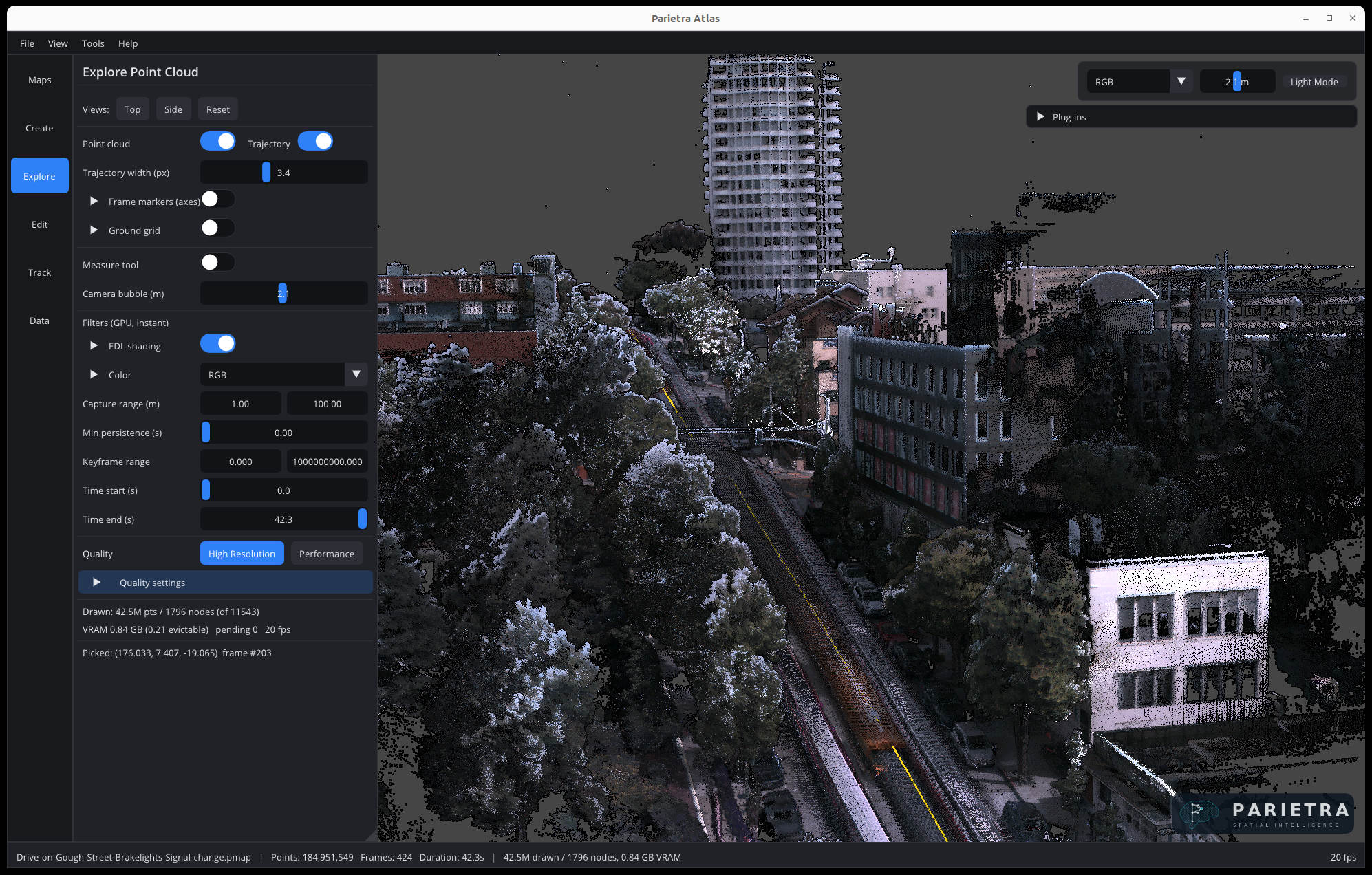
Atlas is organized as a rail you move down as the job progresses. Every stage works on the same single map file, so nothing is exported and re-imported along the way.
Maps
Your collection. Open, merge, archive. Anything in the data folder is listed automatically.
Create
Process a recorded dataset — or scan live from a connected sensor and watch the map build.
Explore
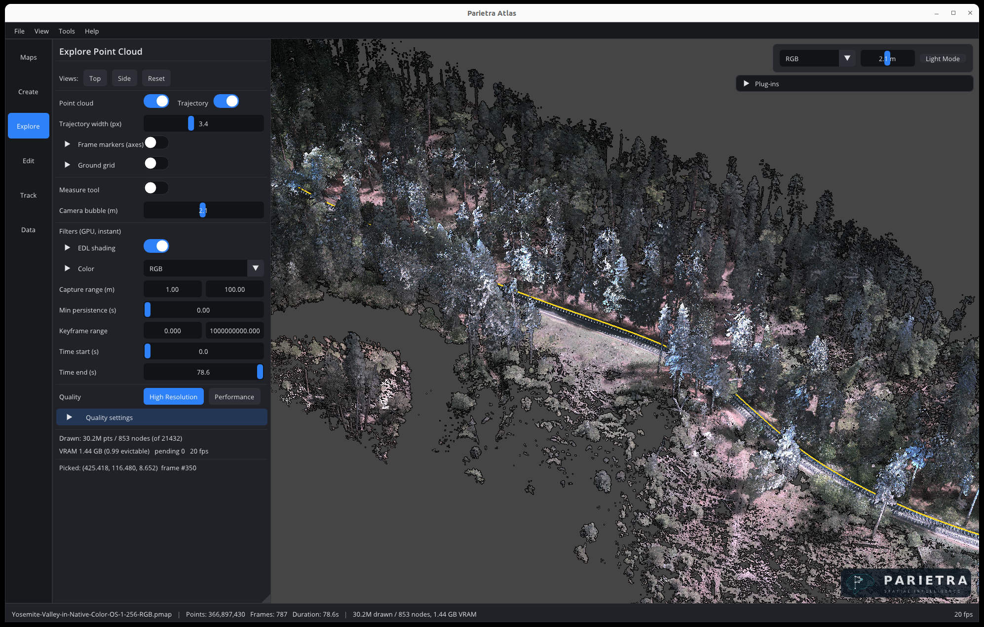
Color by height, intensity, or time. Filter, section, and measure.
Edit
Select and delete, classify, set ground control, and correct the trajectory where the world was hard.
Track
Localize a live sensor or a recording against a finished map.
Data
Import point clouds. Export PLY, LAS, a tracking map, or a dataset.
Repeatable results from the first run.
Atlas's default processing path is deterministic: the same input produces byte-identical output, every time, on the same machine. You can re-run a job months later and diff it.
-
01
Process any recording you already have
ROS 1 bags, ROS 2 MCAP (or bag directories), Ouster OSF and PCAP, and Parietra streams. Atlas inspects the file, finds the point and IMU topics, and can run LiDAR-only when there is no IMU. Queue a whole folder and let it run.
-
02
Scan live, finish at survey quality
With a sensor connected, the map builds on screen in real time while the full-rate raw stream is recorded inside the map file. Post-processing that recording gives exactly the result a direct dataset build would — the preview costs you nothing in final accuracy.
-
03
Scene-aware by default
Atlas probes the first seconds of a dataset and selects processing density for the scene — tight indoor spaces or open terrain — without a settings safari. Explicit profiles remain available when you want control.
-
04
Edit with the trajectory, not against it
Because the map is the trajectory plus raw scans, cleaning and correction happen at the source. Delete, classify, and adjust — and every export reflects it.
-
05
Georeference against site control
Fuse GNSS during capture, or set ground control points on the finished map and adjust it to fit — so a mobile scan lands in the same coordinate system as the rest of your survey, and exports carry it.
-
06
Merge and manage collections
Combine sessions into one map, keep a tidy collection, and archive what you've finished with.
-
07
Forestry toolkit
For plot scans: range and outlier filtering tuned for mobile capture, dynamic-object removal, and stem detection with diameter-at-breast-height estimation that handles partial arcs and large trees. Raw points stay raw — no surface reconstruction that flattens what you measured.
-
08
Track against a finished map
Build a tracking map from any map in your collection and localize a live sensor in it: robust relocalization, GNSS and wheel-odometry fusion, an explicit tracking state, and ROS 1 / ROS 2 wrappers for integration into your stack.
Built to carry your algorithms.
Atlas is built on a plug-in architecture — the Forestry Analysis toolkit ships as a plug-in, not a special case. A plug-in SDK for writing your own data processing is in development, modeled on the same interface forestry is built with.
-
01
Forestry Analysis — in the box
A standard plug-in included with Studio: stem detection with diameter-at-breast-height, tree height, and per-tree metrics, tuned for mobile scans — robust to partial arcs, big trees, and dense canopy. Results come back as a per-tree table you can export.
-
02
Results stay in the workflow
Plug-ins run inside Atlas with their own panel, working on the open map's point data. Results land in the same viewer and the same collection — measure them, filter them, export them. No round-trip through another tool.
-
03
Plug-in SDK — in development
The interface Forestry Analysis is built on is being opened up as an SDK, so research groups and integrators can run their own methods inside Atlas. If you have algorithms to bring, talk to us — early partners help shape it.
Capture from your pocket.
Explorer is the field half of Studio: a phone-driven interface to a backpack or handheld sensor unit. It was designed for people in gloves, standing in a forest, who need the scan to just work. In customer field tests, a plot that took a ~45-minute terrestrial-scanner session walks in about five.
-
01
Power, mode, scan — from the phone
Bring the sensor up or put it in standby, pick the LiDAR mode, point its stream at the unit, and start a scan. Add it to your home screen and it opens like an app.
-
02
Live map as you walk
The map preview builds in the browser in real time. A locked phone or a dropped Wi-Fi link reconnects and catches up on its own; the scan on the unit never stops.
-
03
Straight into the collection
Every scan lands as a standard map file with a timestamped name and your prefix and notes. Open it in Atlas unchanged, or run jobs on the unit — PLY export, the forestry pipeline, compression — and download the result.
-
04
Fewer switches, more sense
Explorer detects its own conditions and acts — falling behind on a long scan, for instance — rather than asking you to know which toggle to flip. The field is no place for a settings page.
The third Studio product tracks cameras.
Arena runs the same engine and the same map format live: a venue or stage mapped with Atlas becomes the reference for real-time, markerless camera tracking — aerial and cable-suspended broadcast cameras, or virtual production stages — delivered to AR graphics at field rate. In live production with FOX Sports for the 2026–27 NFL season.
Inputs, outputs, and requirements.
| Recordings | ROS 1 .bag · ROS 2 .mcap / bag directory · Ouster .osf · Ouster .pcap (+ metadata JSON) · Parietra map archive |
|---|---|
| Live sensors | Ouster OS0 / OS1 / OS-series 128 · Hesai XT32 / OT128 / JT-128 · generic PointCloud2 via ROS |
| IMU | Sensor-integrated IMU or external IMU with configurable LiDAR–IMU extrinsic; LiDAR-only mode when absent |
| Aiding (tracking) | GNSS · wheel odometry |
| Georeferencing | GNSS fusion · ground control points with map adjustment |
| Map | One self-contained file per map — archive, view, edit, and export from the same file; checksummed |
|---|---|
| Exports | PLY · LAS · tracking map · re-exported dataset stream |
| Atlas host | Linux x86-64, modern multi-core CPU; NVIDIA GPU optional for the fast path and preview |
| Explorer host | Small headless Linux computer with wired Ethernet for the sensor and Wi-Fi for the hotspot |
| Integration | ROS 1 and ROS 2 wrappers · command-line tools for batch processing and automation |
Try it on your own data.
Studio is licensed per machine with the features you need — mapping, forestry, export, merge, Arena tracking. Time-limited evaluation licenses are available for qualified teams. Send us a note about your sensor and what you're mapping, and we'll get you set up.