Mobile Scanner Starter Kit.
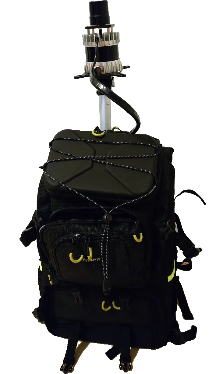
A backpack LiDAR scanner that's ready to walk: an Ouster OS0-128 or OS1-128 Rev 8 sensor, onboard compute, battery, and Parietra Studio in one carry-on-safe pack. It produces a natively colorized point cloud — every point carries true color straight from the sensor, no camera rig, no colorization step. A no-frills, open design you can expand with GNSS when the job asks for it, with no recurring license fees.
Open the case, charge, walk.
Ready on arrival
Everything you need to capture your first plot in one rugged backpack — scanner, computer, battery, monitor, and the software already installed and licensed. Safe to carry on and lug around the world.
Phone-driven capture
The backpack runs Atlas; in the field you control it with Explorer on your phone. Join the unit's Wi-Fi hotspot, press Start, and watch the map build live as you walk. No screen on your back, nothing to babysit.
Straight into Atlas
Every scan lands as a standard map file. Open it in Atlas at the desk to clean, georeference, and export LAS or PLY — or run jobs on the unit in the field and download the result.
An open design
A standard Ubuntu computer you can log into, not a black box. Expand with GNSS when the job asks; a handheld configuration is available too.
You walk. It maps.
A sensor wired to the backpack computer running Atlas, controlled entirely from your phone with Explorer on the unit's own hotspot. A locked phone or a dropped link reconnects and catches up on its own — the scan never stops.
The numbers on the box.
| Specification | Ouster OS0-128 Rev 8 | Ouster OS1-128 Rev 8 |
|---|---|---|
| Scan lines · FoV (h×v) | 128 lines · 360°×90° | 128 lines · 360°×44° |
| Range (10% / 80% refl.) | 35 m / 75 m | 90 m / 170 m |
| Points per second | up to 10.5 million | |
| Range precision · accuracy | ±0.25 to ±1.5 cm · ±1.25 cm | |
| Natively colorized point cloud | Yes — every point carries calibrated RGB captured by the sensor itself; no camera rig, no post-colorization | |
| IMU | TDK InvenSense IAM-20685HP — in-sensor, synchronous | |
| Compute | Intel Core Ultra 7 (Series 2) mini computer · 64 GB RAM · 2 TB SSD | |
| Software | Ubuntu 24.04 · Parietra Studio (Atlas + Explorer) | |
| Battery · active scanning | 99 Wh (6900 mAh) · 1.5+ hours — optional 140 Wh (9600 mAh) · 2+ hours | |
| Backpack (h×w×d) | 51 × 34 × 22 cm · 20.1 × 13.4 × 8.7 in | |
| Total weight | ~8 kg · ~17.6 lb | |
| Operating temperature | 0–40 °C · 32–104 °F (system; the LiDAR itself is rated −40 to +85 °C) | |
In the pack
- Rugged backpack design — safe to carry on and lug around the world
- Free your hands to safely navigate your environment
- Everything you need in one package — store, transport, and scan
- Ouster OS0-128 or OS1-128 Rev 8 LiDAR with built-in IMU, producing a natively colorized point cloud
- Powerful Intel Core Ultra 7 (Series 2) mini computer — 64 GB RAM, 2 TB SSD
- USB-C portable monitor, wireless keyboard and mouse
- 99 Wh battery — optional 140 Wh
- Parietra Studio — capture and post-processing software, installed and licensed
Tell us where it's going.
Both sensors are 128-line Rev 8 units with native color; the choice depends on your environment — OS0-128's wide field of view for forests and interiors, OS1-128's reach for open sites. Tell us what you're mapping and we'll spec the right configuration and quote it.